
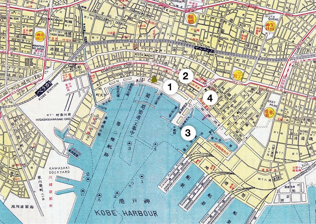
The Kobe Bund in 1930 (Showa 5), lined with the offices of steamship companies and trading houses.
The tall building in the back with the rounded ornament on the corner is the office of Osaka Shosen Kaisha, a major Osaka-based steamship line. It is one of the only buildings on this photo that still stands today.
The original seawall has already been replaced by a train-track, warehouses and a quay, greatly extending the port into the harbor. Where the warehouses and the quay end, at the top-right, the old American Hatoba starts. It was through this pier that once all visitors entered Kobe. Today, that location is the entrance to Meriken Park.
After Kobe was opened as a harbor to foreign trade in 1868 (Meiji 1), it quickly grew into Japan’s most important harbor. In the early 20th century Kobe handled even more trade than Yokohama, even though that city had been opened as early as 1859.
Kobe’s exports at the time of this photograph consisted of an incredible range of goods: matches, whale-oil, tea, sake, vegetable wax, refined camphor, peppermint oil, agar agar (寒天, kanten), pearl buttons, straw matting, toothbrushes, porcelain, rice, cotton, copper, woolen cloth, and so on.
The enormous wealth that the trade in these goods created is clearly visible from the imposing buildings that line the street. It is almost impossible to imagine that only some sixty odd years earlier this had been an often flooded wasteland.

Published
Updated
Reader Supported
Old Photos of Japan aims to be your personal museum for Japan's visual heritage and to bring the experiences of everyday life in old Japan to you.
To enhance our understanding of Japanese culture and society I track down, acquire, archive, and research images of everyday life, and give them context.
I share what I have found for free on this site, without ads or selling your data.
Your support helps me to continue doing so, and ensures that this exceptional visual heritage will not be lost and forgotten.
Thank you,
Kjeld Duits
Reference for Citations
Duits, Kjeld (). Kobe 1930: The Bund, OLD PHOTOS of JAPAN. Retrieved on August 2, 2026 (GMT) from https://www.oldphotosjapan.com/photos/454/the-bund

There are currently no comments on this article.