
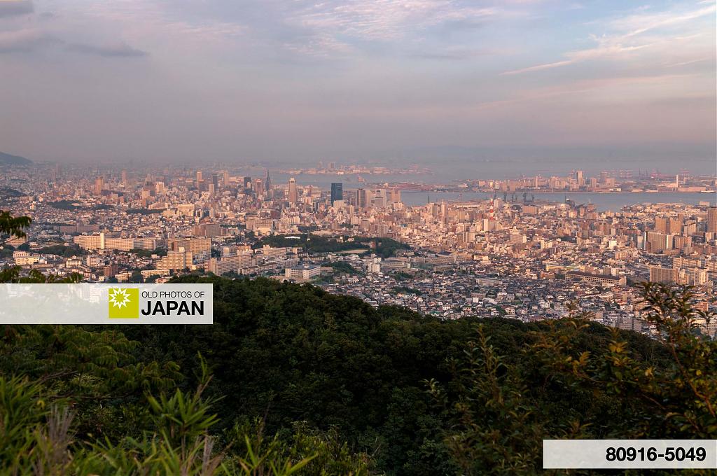
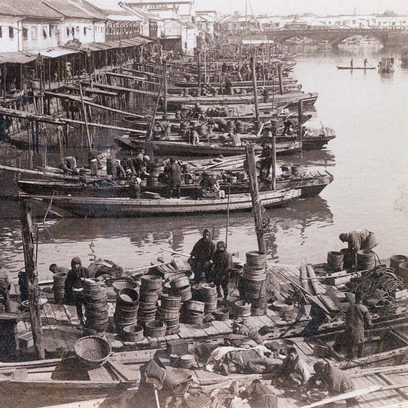
A beautiful view of a yet very rural Kobe from Mount Takatori (高取山) in the early 1870s. Very soon after the city was opened to foreign trade on January 1, 1868 (Keiō 4). This is Kobe in the cradle.
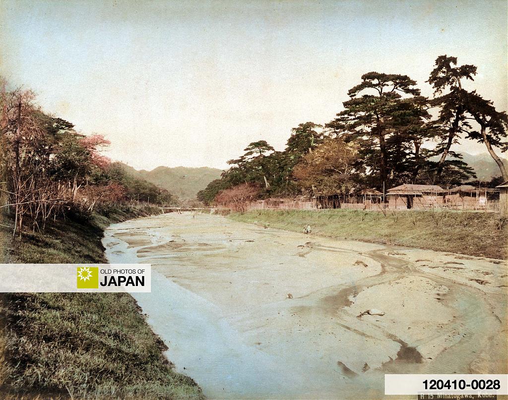
The line of trees in the center is the Minatogawa River (湊川). Beyond that is Kobe Harbor and the Foreign Settlement. Across the bay, the mountains of Osaka and Nara can be seen.
The Minatogawa was a beautiful river lined by tall trees. It was a popular place for entertainment with small tea stands along its banks. Sadly, the powers that be felt that the river was a public nuisance and stood in the way of Kobe’s further development.
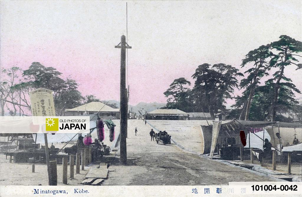
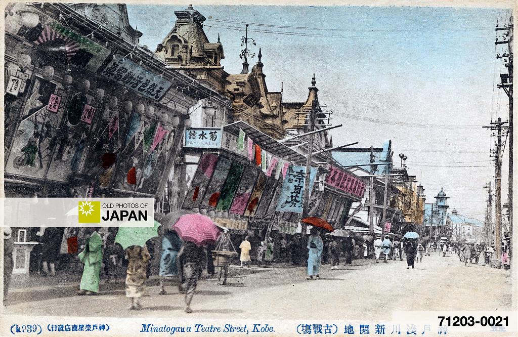
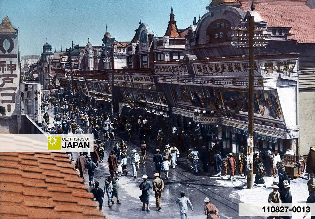
In 1901 (Meiji 34), the river was relocated. In its stead, the Minatogawa Shinkaichi (湊川新開地) theater and entertainment district was opened here in 1905 (Meiji 38). It became Kobe’s premier entertainment district, conveniently close to the Fukuhara brothel district.
Behind the Scenes
Because this image was a bit tricky to research, I thought it’d be interesting to share a look behind the scenes at Old Photos of Japan. How I go about finding the locations of the vintage photographs in my collection.
Sometimes, locating an image is very simple, and takes no effort at all. Images of the imperial palaces in Kyoto and Tokyo are straightforward as relatively little has changed. The same is true for images of well-known locations like Ginza Avenue and Asakusa in Tokyo. There are tons of vintage photos of these places, and they are in your head before you know.
I basically only need to date them. That is done by looking at the buildings and checking when they were built or torn down. Often, the name of a business helps a lot. Directories that were printed annually give a decent idea of when businesses were active at a certain location.
But panoramas can be tough. I want to know exactly where the photographer stood so that it becomes possible to identify individual areas and buildings.
When I purchased this photograph way back in 2008, I was pretty confident that it was Kobe because I recognized aspects from other vintage photography of the town.
But I had no idea from what location this was photographed, and how the photo corresponded with modern Kobe. Kobe has changed so much since this photo was taken that it was extremely difficult to accurately connect the geographic points visible on the photo with their modern locations. Even the curators at the Kobe City Museum had no idea where this photograph was taken.
The vintage photograph features several large ponds with characteristic shapes. So, I started by visiting the Kobe City Central Library (兵庫県神戸市立中央図書館). They have a wonderful collection of large vintage maps. After going through quite a few of them, I was eventually able to identify the ponds and therefore the general location where the photographer had shot this photograph.
Now I went hiking to find the exact spot. This was when I first started out doing research and I didn’t always think things through very well. On the old maps, I should have checked what paths and buildings already existed in the 1870s. Instead, I just started walking the mountain paths.
After several days of hiking, I ended up at Takatori Shrine (高取神社), a place I should have gone right away. Very close to the shrine was a large stone lantern (大灯籠) used as a simple light house. It was originally built in 1897 (Meiji 30), but was destroyed by the 1995 earthquake that leveled Kobe and surroundings. In 2001, the 1,800th anniversary of the founding of the shrine, the lantern was rebuilt.
The lantern was built several decades after the photograph was taken. But, when I arrived, I immediately knew that this was the spot. That is the great advantage of putting your boots on the ground.
The lens that I used to shoot the same view is of course very different from the one that the 19th century photographer used. So, distances on the vintage photo differ from those on the modern one. But by comparing the two photographs, you eventually start to recognize spots.
Here are some of the points that I compared:
2. Meriken Pier at the Foreign Settlement (current Meriken Park)
3. Landing Pier (current Kobe Harborland)
4. Minatogawa Jinja shrine (湊川神社)
5. Minatogawa River (current Shinkaichi)
6. Higashi-Kawasaki (東川崎)
7. Hyōgo Village (current Hyōgo-ku)
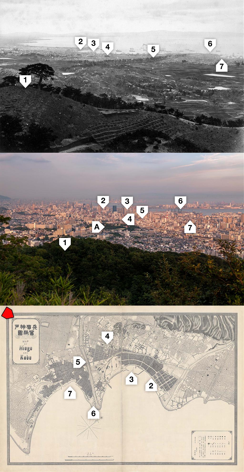
Since I researched this photograph, Google Street View has become available and things have become a bit easier. But even today, nothing compares to actually standing at the same spot as the photographer. You get a feel of the place that you don’t get from photographs, and you can more easily compare mountain ranges like the ones visible in this image.
Incidentally, this appears to be quite a rare image. Since I purchased it in 2008, I have not yet seen any other print. If you know of one, please let me know!
Published
Reader Supported
Old Photos of Japan aims to be your personal museum for Japan's visual heritage and to bring the experiences of everyday life in old Japan to you.
To enhance our understanding of Japanese culture and society I track down, acquire, archive, and research images of everyday life, and give them context.
I share what I have found for free on this site, without ads or selling your data.
Your support helps me to continue doing so, and ensures that this exceptional visual heritage will not be lost and forgotten.
Thank you,
Kjeld Duits
Reference for Citations
Duits, Kjeld (). Kobe 1870s: View on Kobe from Mt. Takatori, OLD PHOTOS of JAPAN. Retrieved on July 26, 2026 (GMT) from https://www.oldphotosjapan.com/photos/873/view-on-kobe-from-mt-takatori-1870s-meiji
There are currently no comments on this article.