
Harbor launches at the Meriken (American) Hatoba, for many years the main pier in Kobe.
Until 1922 (Taisho 11), large ships couldn’t dock in the harbor, so the hooting launches maneuvered continuously through the multitudes of junks and other small vessels to shuttle passengers and their luggage between anchored ships and the pier.
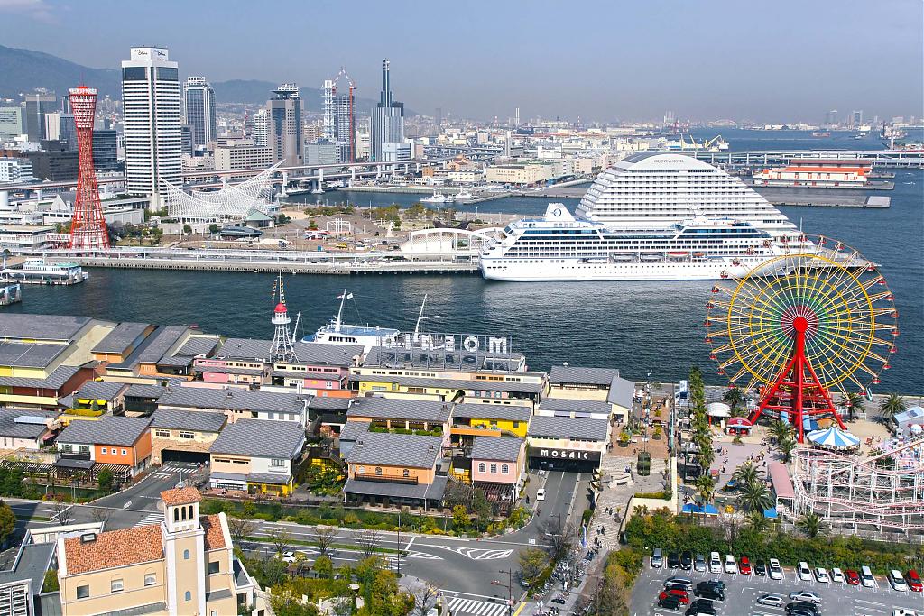
As the harbor developed, Meriken Hatoba lost its importance as place of entry and in 1987 (Showa 62) the pier finally vanished as it was incorporated into Meriken Park.
At the time that this photo was shot, Kobe Port had already transformed into one of Japan’s main ports with lots of traffic. An Official Guide to Eastern Asia, published in 1914 (Taisho 3), gives an impression of the port at that time1:
The merchant vessels of all kinds in both home and foreign trade, which entered and cleared the harbour of Kōbe during 1909 amounted to 15,327, of which those engaged in foreign trade numbered 2,418. During 1909 passengers by sea landing at Kōbe numbered 213,405 from ships coasting in home waters and 19,407 from ocean-going steamers. The total was 232,802, of which 6,183 were foreigners. Among these latter Chinese numbered 2,476, Britons 1,493, Americans 1,090, Germans 320, Russians 308, and French 146.
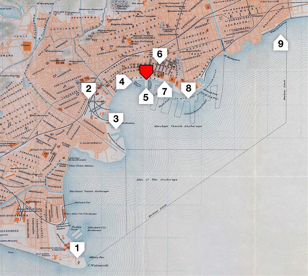
To simplify management and development, the harbor was divided into two areas:
- Wakinohama (#9 on map below) to the Kawasaki promontory (#3) for merchant ships and junks.
- Kawasaki promontory (#3) to Wadanomisaki (#1) used especially for vessels of the Japanese navy.
Passengers landed at the Meriken Hatoba (#5) and the nearby Daisan Hatoba (#4, Third Wharf), located about where Kobe Port Tower is now.
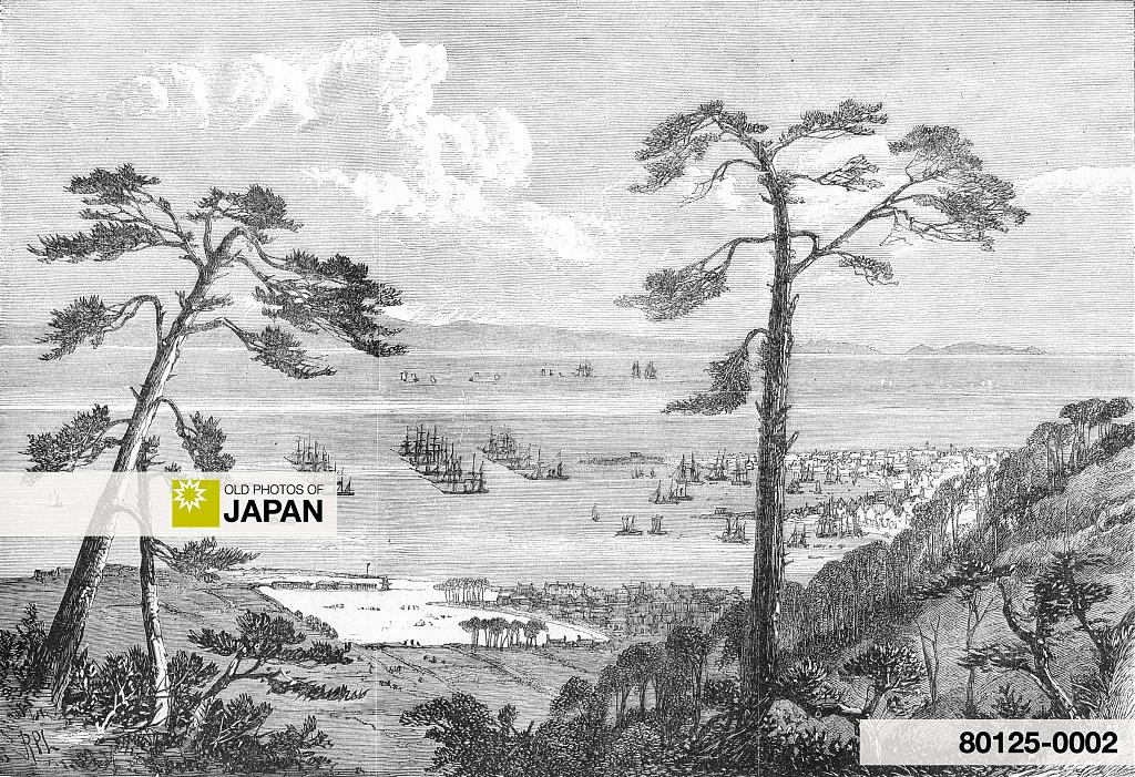
Kobe Port was first opened to foreign trade in 1868 (Keio 4). At that time it had no wharfs to serve large vessels so loading and offloading had to take place offshore. This situation persisted for a long time.
Finally in 1907 (Meiji 40), due to dramatic increases in trade, plans were made for extensive new port facilities (#7 on the above map). During the so-called First Stage Kobe Port Development Plan (1907-1922), four new piers were constructed (Shinko piers No. 1 through No. 4).
In 1919 (Taisho 8), work began on the Second Stage, which included the construction of six new piers (Shinko piers No. 4 East through No. 6, Naka Pier, and Hyogo Piers No. 1 and 2). This was completed in 1939 (Showa 14).
Kobe now had the largest berth in Japan, with a depth of 12m.
After the end of WWII, construction continued to make Kobe one of the world’s busiest ports. The tops of the mountains to the northwest of the city were even sliced off to construct the artificial islands Port Island (ポートアイランド) and Rokko Island (六甲アイランド).
This clip shows some of this massive construction work in 1969 (Showa 44), as well as the enormous environmental destruction it caused.
The Great Hanshin Earthquake of 1995 (Heisei 7) put an end to Kobe’s growth. The damage that it caused to the port facilities amounted to 2.5% of Japan’s GDP.
Despite immense investments and the addition of an airport (also built on an artificial island), Kobe Port has not managed to regain its former status as Japan’s principal shipping port. It now ranks fourth after Tokyo, Yokohama and Nagoya.2

Timeline of Kobe Port
| 1868 | Hyogo Port is opened |
|---|---|
| 1892 | The harbor is officially named Port of Kobe |
| 1907–1922 | Construction of Shinko Piers No. 1-4 (West) |
| 1919–1939 | Construction of Shinko Piers No. 4 (East)-No. 6, Naka Pier, Hyogo Piers (No. 1 & 2) |
| 1923 | Kobe is designated a national principal port |
| 1951–1956 | Construction of Shinko Piers No. 7 West & East |
| 1958–1967 | Construction of Hyogo No. 3 Pier, Maya Piers, Shinko No. 8 Pier (East) |
| 1963 | Kobe Port Tower completed |
| 1966–1981 and 1987–2010 | Reclamation of Port Island |
| 1972–1992 | Reclamation of Rokko Island |
| 1992–1987 | Construction of Meriken Park |
| 1995 | Great Hanshin-Awaji Earthquake causes great damage to Kobe Port |
| 1999–2006 | Construction of Kobe Airport |
Source: Port & Urban Projects Bureau Kobe City Government. Port of Kobe. Retrieved on 2008-07-21.

Notes
1 Imperial Japanese Government Railways. (1914). An Official Guide to Eastern Asia Vol. II: South Western Japan. Imperial Japanese Government Railways.
2 American Association of Port Authorities. World Port Rankings. Retrieved on 2021-08-23.
Published
Updated
Reader Supported
Old Photos of Japan aims to be your personal museum for Japan's visual heritage and to bring the experiences of everyday life in old Japan to you.
To enhance our understanding of Japanese culture and society I track down, acquire, archive, and research images of everyday life, and give them context.
I share what I have found for free on this site, without ads or selling your data.
Your support helps me to continue doing so, and ensures that this exceptional visual heritage will not be lost and forgotten.
Thank you,
Kjeld Duits
Reference for Citations
Duits, Kjeld (). Kobe 1910s: Steam Launches, OLD PHOTOS of JAPAN. Retrieved on July 28, 2026 (GMT) from https://www.oldphotosjapan.com/photos/304/steam-boats


There are currently no comments on this article.